gis Courses
Comprehensive gis training programs for professionals
Comprehensive gis training programs for professionals
Geospatial Semantic Web and Linked Data Training Course provides a deep dive into the architectures and standards that underpin the Geospatial Semantic Web.
Geospatial Semantic Web and Linked Data Training Course provides a deep dive into the architectures and standards that underpin the Geospatial Semantic Web.
Geospatial SQL and NoSQL Databases (PostGIS, MongoDB) Training Course bridges that gap, equipping professionals with the expertise to leverage both SQL (PostGIS) and NoSQL (MongoDB) database technologies for robust geospatial data management, analysis, and visualization
Geospatial SQL and NoSQL Databases (PostGIS, MongoDB) Training Course bridges that gap, equipping professionals with the expertise to leverage both SQL (PostGIS) and NoSQL (MongoDB) database technologies for robust geospatial data management, analysis, and visualization
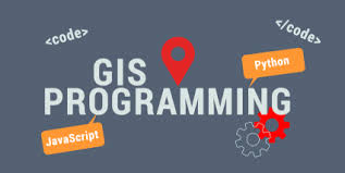
Geospatial Statistical Programming with Python Training Course introduces participants to the powerful realm of Geospatial Statistical Programming with Python, equipping them with the cutting-edge skills to analyze, interpret, and visualize geographical information effectively.
Geospatial Statistical Programming with Python Training Course introduces participants to the powerful realm of Geospatial Statistical Programming with Python, equipping them with the cutting-edge skills to analyze, interpret, and visualize geographical information effectively.
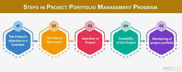
Geospatial Project Portfolio Management Training Course introduces participants to the critical domain of Geospatial Project Portfolio Management (GPPM), empowering them to strategically align, prioritize, and execute geospatial initiatives for maximum organizational impact.
Geospatial Project Portfolio Management Training Course introduces participants to the critical domain of Geospatial Project Portfolio Management (GPPM), empowering them to strategically align, prioritize, and execute geospatial initiatives for maximum organizational impact.
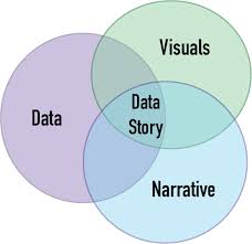
Geospatial Storytelling with Data Narratives Training Course empowers professionals to unlock the immense power of location intelligence.
Geospatial Storytelling with Data Narratives Training Course empowers professionals to unlock the immense power of location intelligence.
Geospatial Visualization with Game Engines (Unity, Unreal Engine) Training Course will equip professionals with the cutting-edge skills to leverage these powerful platforms, transforming static maps into dynamic, interactive 3D environments for enhanced decision-making and storytelling
Geospatial Visualization with Game Engines (Unity, Unreal Engine) Training Course will equip professionals with the cutting-edge skills to leverage these powerful platforms, transforming static maps into dynamic, interactive 3D environments for enhanced decision-making and storytelling
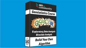
Geostatistical Modeling Training Course provides a comprehensive understanding of geostatistical modeling, focusing specifically on Kriging and advanced interpolation techniques.
Geostatistical Modeling Training Course provides a comprehensive understanding of geostatistical modeling, focusing specifically on Kriging and advanced interpolation techniques.
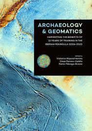
GIS for Archaeology and Cultural Heritage Mapping Training Course provides archaeologists, heritage professionals, and cultural resource managers with essential skills in Geographic Information Systems (GIS) for advanced archaeological research, cultural heritage management, and digital preservation.
GIS for Archaeology and Cultural Heritage Mapping Training Course provides archaeologists, heritage professionals, and cultural resource managers with essential skills in Geographic Information Systems (GIS) for advanced archaeological research, cultural heritage management, and digital preservation.
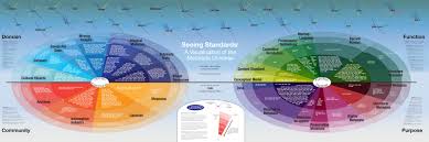
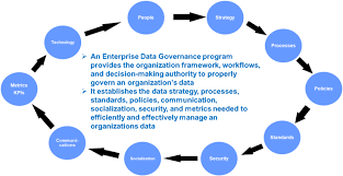
Training Course on Geospatial Data Governance and Policy is meticulously designed to equip professionals with the critical knowledge and practical skills needed to establish, implement, and maintain effective geospatial data governance, ensuring data quality, security, and ethical use across organizations.
Training Course on Geospatial Data Governance and Policy is meticulously designed to equip professionals with the critical knowledge and practical skills needed to establish, implement, and maintain effective geospatial data governance, ensuring data quality, security, and ethical use across organizations.
Training Course on Geospatial Data Pipelines for Web Applications will equip participants with the essential skills and knowledge to design, build, and deploy efficient geospatial data pipelines.
Training Course on Geospatial Data Pipelines for Web Applications will equip participants with the essential skills and knowledge to design, build, and deploy efficient geospatial data pipelines.
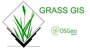
Training Course on Geospatial Data Processing with GRASS GIS provides a comprehensive introduction to Geospatial Data Processing using GRASS GIS, a powerful open-source Geographic Information System.
Training Course on Geospatial Data Processing with GRASS GIS provides a comprehensive introduction to Geospatial Data Processing using GRASS GIS, a powerful open-source Geographic Information System.
Training Course on Geospatial Data Quality Assessment and Improvement is meticulously designed to bridge the gap between theoretical understanding and real-world application, emphasizing practical exercises, case studies, and industry best practices.
Training Course on Geospatial Data Quality Assessment and Improvement is meticulously designed to bridge the gap between theoretical understanding and real-world application, emphasizing practical exercises, case studies, and industry best practices.