gis Courses
Comprehensive gis training programs for professionals
Comprehensive gis training programs for professionals
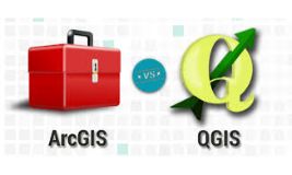
raining Course on GIS Using ArcGIS or QGIS is designed to empower participants with the knowledge and skills to harness GIS for data visualization, spatial analysis, and decision-making
raining Course on GIS Using ArcGIS or QGIS is designed to empower participants with the knowledge and skills to harness GIS for data visualization, spatial analysis, and decision-making
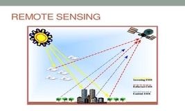
Training Course on GIS and Remote Sensing in Disaster Risk Management is designed to equip professionals with the skills to effectively use these technologies in disaster preparedness response, and recovery efforts. This course emphasizes practical applications of GIS and Remote Sensing in disaster risk management
Training Course on GIS and Remote Sensing in Disaster Risk Management is designed to equip professionals with the skills to effectively use these technologies in disaster preparedness response, and recovery efforts. This course emphasizes practical applications of GIS and Remote Sensing in disaster risk management
Training Course on GIS in Disaster Risk Management course explores how GIS can be integrated into DRM practices, providing hands-on experience with GIS tools and techniques tailored to disaster management scenarios
Training Course on GIS in Disaster Risk Management course explores how GIS can be integrated into DRM practices, providing hands-on experience with GIS tools and techniques tailored to disaster management scenarios
Join our expert-led GIS and Remote Sensing for Agricultural Resource Management training course and gain hands-on skills in geospatial analysis, precision farming, and sustainability. Learn how GIS and remote sensing can optimize agricultural productivity, resource allocation, and climate resilience.
Join our expert-led GIS and Remote Sensing for Agricultural Resource Management training course and gain hands-on skills in geospatial analysis, precision farming, and sustainability. Learn how GIS and remote sensing can optimize agricultural productivity, resource allocation, and climate resilience.
Web-Based GIS and Mapping Training Course equip professionals with the skills necessary to effectively use web-based GIS tools for data visualization, mapping, and spatial analysis
Web-Based GIS and Mapping Training Course equip professionals with the skills necessary to effectively use web-based GIS tools for data visualization, mapping, and spatial analysis
Training Course on GIS and Statistical Analysis for WASH Programmes equip professionals with the essential skills required to analyze and interpret spatial data and statistical information to improve WASH interventions
Training Course on GIS and Statistical Analysis for WASH Programmes equip professionals with the essential skills required to analyze and interpret spatial data and statistical information to improve WASH interventions
Training Course on Digital Photogrammetric Mapping and Terrain Modelling is designed to equip professionals with the skills necessary to use photogrammetric techniques for accurate data
Training Course on Digital Photogrammetric Mapping and Terrain Modelling is designed to equip professionals with the skills necessary to use photogrammetric techniques for accurate data
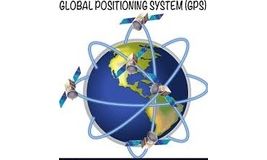
Training Course on GNSS Technologies for Precise Applications is designed to offer a comprehensive understanding of GNSS technology and its practical uses in fields
Training Course on GNSS Technologies for Precise Applications is designed to offer a comprehensive understanding of GNSS technology and its practical uses in fields
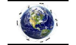
Training Course on GPS and Mobile Mapping for General Applications equips participants with the knowledge and skills to harness these tools for real-world applications
Training Course on GPS and Mobile Mapping for General Applications equips participants with the knowledge and skills to harness these tools for real-world applications
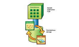
Training Course on Geodatabase Analytical Techniques empower professionals with the skills to create, manage, and analyze spatial data using advanced geodatabase systems.
Training Course on Geodatabase Analytical Techniques empower professionals with the skills to create, manage, and analyze spatial data using advanced geodatabase systems.
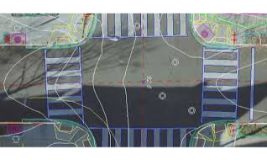
Training course on Introduction to Digital Cartography and GIS Mapping offers a comprehensive overview of GIS principles and the technologies involved in the creation of maps and spatial models, ensuring participants develop the skills necessary to manage and interpret geographic data effectively.
Training course on Introduction to Digital Cartography and GIS Mapping offers a comprehensive overview of GIS principles and the technologies involved in the creation of maps and spatial models, ensuring participants develop the skills necessary to manage and interpret geographic data effectively.
Training Course on Disaster Risk Reduction in Emergencies equip professionals with the skills to effectively reduce risk, prepare for emergencies, and respond efficiently in the event of a crisis
Training Course on Disaster Risk Reduction in Emergencies equip professionals with the skills to effectively reduce risk, prepare for emergencies, and respond efficiently in the event of a crisis