Transfer Learning in Geospatial Deep Learning Training Course
Transfer Learning in Geospatial Deep Learning Training Course emphasizes practical implementation and real-world problem-solving in areas such as environmental monitoring, urban planning, disaster management, and resource optimization.
Course Overview
Transfer Learning in Geospatial Deep Learning Training Course
Introduction
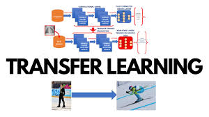
The convergence of Geospatial Intelligence (GeoAI) and Deep Learning (DL) has ushered in a new era for analyzing complex spatial data. Traditional deep learning models often require massive, labeled datasets and extensive computational resources for training from scratch, a significant hurdle in the geospatial domain where labeled data can be scarce and diverse. Transfer Learning emerges as a powerful paradigm, enabling the leveraging of pre-trained models on large, generic datasets to accelerate and enhance performance on specific geospatial tasks with limited data. This course delves into the theoretical foundations and practical applications of transfer learning, equipping participants with the skills to unlock unprecedented insights from satellite imagery, LiDAR, and other geospatial data.
Transfer Learning in Geospatial Deep Learning Training Course emphasizes practical implementation and real-world problem-solving in areas such as environmental monitoring, urban planning, disaster management, and resource optimization. Participants will gain hands-on experience with cutting-edge deep learning frameworks and libraries, learning to fine-tune state-of-the-art architectures for tasks like land cover classification, object detection, change detection, and spatial prediction. By mastering transfer learning techniques, professionals can significantly reduce development time, improve model accuracy, and derive actionable intelligence from vast geospatial datasets, driving innovation and efficiency across various industries.
Course Duration
10 days
Course Objectives
- Master the fundamental concepts of deep learning architectures relevant to geospatial data.
- Understand the theoretical underpinnings and practical benefits of transfer learning in resource-constrained environments.
- Gain proficiency in geospatial data preprocessing and augmentation techniques for deep learning pipelines.
- Implement and fine-tune pre-trained Convolutional Neural Networks (CNNs) for various geospatial image analysis tasks.
- Apply transfer learning to land cover and land use classification using satellite and aerial imagery.
- Develop robust object detection models for geospatial features like buildings, roads, and vehicles.
- Execute advanced change detection methodologies utilizing deep learning and transfer learning.
- Explore and utilize specialized geospatial deep learning libraries and frameworks (e.g., PyTorch, TensorFlow, ArcGIS API for Python).
- Evaluate and interpret the performance of deep learning models using appropriate geospatial metrics.
- Address challenges related to imbalanced datasets and domain adaptation in geospatial transfer learning.
- Design and deploy scalable deep learning solutions for large-scale geospatial analytics.
- Integrate transfer learning models into existing GIS workflows for enhanced spatial intelligence.
- Stay updated with emerging trends and research in GeoAI and foundation models for Earth Observation.
Organizational Benefits
- Drastically reduces the time and resources required to develop high-performing AI models for geospatial applications by leveraging pre-trained networks instead of training from scratch.
- Provides deeper, data-driven insights from complex spatial data, enabling more informed and proactive decision-making across various departments.
- Minimizes computational costs associated with extensive model training and reduces the need for massive, expensively labeled proprietary datasets.
- Leads to more accurate and generalizable models, even with limited domain-specific data, by building upon robust features learned from diverse source datasets.
- Fosters an internal capacity for cutting-edge geospatial AI applications, positioning the organization as a leader in leveraging advanced spatial analytics.
- Optimizes the use of personnel and computing infrastructure, as less time is spent on fundamental model training and more on application-specific fine-tuning and analysis.
- Enables the development of scalable solutions capable of processing and analyzing vast amounts of real-time and archived geospatial data.
- Provides effective strategies for developing powerful AI models even in scenarios where acquiring large, labeled geospatial datasets is challenging.
Target Audience
- GIS Professionals & Analysts
- Remote Sensing Specialists.
- Data Scientists & AI/ML Engineers.
- Environmental Scientists & Conservationists.
- Urban Planners & Civil Engineers
- Disaster Management & Humanitarian Aid Workers
- Researchers & Academics.
- Developers of Geospatial Solutions
Course Outline
Module 1: Introduction to Geospatial Deep Learning & Transfer Learning Fundamentals
- Overview of the Deep Learning revolution and its impact on Geospatial AI.
- Introduction to geospatial data types (raster, vector, point clouds) and their unique characteristics for deep learning.
- The concept of transfer learning: why it's crucial for geospatial data, especially with limited labeled data.
- Fine-tuning, feature extraction, and pre-trained models: understanding the core strategies.
- Setting up the development environment: Python, Anaconda, TensorFlow/PyTorch, GDAL, Rasterio.
- Case Study: ImageNet pre-training for satellite image classification.
Module 2: Geospatial Data Preprocessing and Augmentation for Deep Learning
- Techniques for geospatial data acquisition and preparation (e.g., satellite image tiles, normalization).
- Radiometric and atmospheric correction for remote sensing imagery.
- Data augmentation strategies specifically tailored for geospatial images (e.g., rotations, flips, color jitter, spatial transformations).
- Handling multi-spectral and hyperspectral data for deep learning inputs.
- Addressing imbalanced datasets in geospatial classification tasks.
- Case Study: Augmenting limited urban land cover data to improve model generalization.
Module 3: Convolutional Neural Networks (CNNs) for Geospatial Imagery
- Deep dive into CNN architecture: convolution layers, pooling, activation functions.
- Understanding feature hierarchies learned by CNNs from spatial data.
- Popular CNN architectures: ResNet, VGG, U-Net, and their relevance to geospatial tasks.
- Building basic CNNs from scratch for simple image classification.
- Introduction to semantic segmentation and its importance in mapping.
- Case Study: Using a simple CNN for basic cloud detection in satellite images.
Module 4: Transfer Learning Strategies for Geospatial Image Classification
- Freezing layers: effective techniques for leveraging pre-trained weights.
- Fine-tuning pre-trained CNNs: adapting models to specific geospatial domains.
- Choosing the right pre-trained model for different geospatial tasks (e.g., ImageNet vs. Remote Sensing specific pre-trained models).
- Learning rate scheduling and optimization for transfer learning.
- Strategies for handling domain shift between source and target geospatial datasets.
- Case Study: Classifying agricultural crops using a pre-trained ResNet on Sentinel-2 imagery.
Module 5: Advanced Land Cover and Land Use Classification
- Implementing U-Net and other encoder-decoder architectures for semantic segmentation.
- Applying transfer learning for pixel-level classification of land cover types.
- Working with large-scale land cover mapping datasets and strategies for tiling/inference.
- Evaluating segmentation models: Intersection over Union (IoU), F1-score, accuracy.
- Integrating temporal information for improved classification accuracy.
- Case Study: Urban expansion mapping using multi-temporal Landsat imagery with transfer learning.
Module 6: Object Detection in Geospatial Imagery
- Introduction to object detection models: YOLO (You Only Look Once), Faster R-CNN, SSD.
- Adapting and fine-tuning pre-trained object detection models for geospatial features.
- Detecting features like buildings, vehicles, and infrastructure from aerial and satellite photos.
- Annotation tools and strategies for creating object detection datasets.
- Handling small object detection challenges in high-resolution imagery.
- Case Study: Identifying damaged buildings in post-disaster satellite imagery.
Module 7: Change Detection with Transfer Learning
- Fundamentals of change detection in remote sensing.
- Deep learning architectures for change detection: Siamese networks, UNet++.
- Applying transfer learning to identify land-use changes, deforestation, and urban growth.
- Post-processing change maps and assessing change significance.
- Handling seasonal variations and atmospheric effects in change detection.
- Case Study: Monitoring deforestation rates in the Amazon rainforest using Sentinel-1/2 data.
Module 8: Introduction to Foundation Models for Earth Observation
- Understanding the concept of Foundation Models and their potential in GeoAI.
- Exploring emerging large-scale pre-trained models specifically for Earth Observation.
- Self-supervised learning and its role in training geospatial foundation models.
- Prompt engineering and adapting foundation models for specific tasks.
- Challenges and opportunities in utilizing these massive models in resource-constrained settings.
- Case Study: Exploring applications of open-source Earth Observation foundation models for land cover mapping.
Module 9: Geospatial Time Series Analysis with Deep Learning
- Handling temporal sequences of geospatial data (e.g., satellite image stacks, climate data).
- Recurrent Neural Networks (RNNs) and Long Short-Term Memory (LSTM) for time series.
- Transformer architectures for sequential geospatial data.
- Predictive modeling of spatial phenomena over time.
- Integrating temporal and spatial information in deep learning models.
- Case Study: Predicting crop yield based on multi-temporal vegetation indices from satellite data.
Module 10: Deep Learning for LiDAR and Point Cloud Data
- Introduction to LiDAR data and its representation (point clouds).
- Deep learning architectures for point clouds: PointNet, PointCNN.
- Applying transfer learning to 3D object detection and semantic segmentation of point clouds.
- Feature extraction from LiDAR for urban modeling and forestry.
- Integration of LiDAR with optical imagery for multi-modal deep learning.
- Case Study: Classifying urban infrastructure (buildings, roads, power lines) from aerial LiDAR scans.
Module 11: Geospatial Deep Learning Libraries and Frameworks
- Deep dive into PyTorch and TensorFlow for building and training geospatial models.
- Utilizing specialized geospatial libraries: TorchGeo, Kornia, OpenStreetMap data integration.
- Efficiently handling large-scale geospatial datasets with Dask and Zarr.
- GPU acceleration for deep learning training and inference.
- Model deployment strategies for geospatial AI applications.
- Case Study: Building an end-to-end land parcel classification pipeline using PyTorch and TorchGeo.
Module 12: Explainable AI (XAI) in Geospatial Deep Learning
- The importance of interpretability and transparency in AI for critical geospatial applications.
- Techniques for understanding CNN decisions: Grad-CAM, LIME.
- Identifying model biases in geospatial predictions.
- Ethical considerations in deploying geospatial AI systems.
- Communicating deep learning insights to non-technical stakeholders.
- Case Study: Explaining why a deep learning model misclassified a particular land cover type.
Module 13: Geospatial Deep Learning Model Evaluation and Validation
- Quantitative metrics for regression, classification, and segmentation tasks
- Spatial cross-validation and its importance in preventing overfitting to spatial dependencies.
- Error analysis and identifying sources of model failure.
- Uncertainty quantification in deep learning predictions.
- Best practices for reporting and presenting geospatial deep learning results.
- Case Study: Validating a flood extent mapping model against ground truth data.
Module 14: Integrating Deep Learning with GIS Workflows
- Bridging the gap between deep learning models and traditional GIS software.
- Using ArcGIS API for Python or QGIS plugins for deep learning integration.
- Automating geospatial analysis pipelines with deep learning components.
- Web GIS integration: serving deep learning model outputs via mapping platforms.
- Case studies of real-world geospatial AI deployments in industry and government.
- Case Study: Integrating a trained object detection model into an ArcGIS Pro project for automated feature extraction.
Module 15: Future Trends and Advanced Topics in GeoAI
- Graph Neural Networks (GNNs) for spatial networks and relationships.