Best GIS Courses in 2026
Visualize and analyze data geographically using expert GIS training. Perfect for mapping, urban planning, and spatial analysis.
Available Courses
Students Trained
Days Duration
Rating
Why Choose Our GIS Training?
Our GIS courses are designed to provide you with practical skills and knowledge that you can immediately apply in your professional environment.
Expert Instructors
Learn from industry professionals with years of practical experience
Hands-on Training
Practical, real-world applications and case studies
Certification
Receive recognized certificates upon successful completion
Career Support
Ongoing support and networking opportunities
Featured GIS Courses
Explore our most popular GIS courses designed to advance your career.
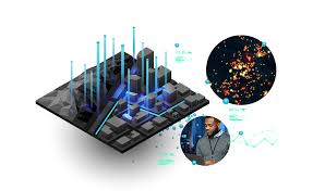
GIS Data Integration Training Course
GIS Data Integration Training Course equips professionals with the technical expertise to merge spatial and non-spatial datasets, implement automated workflows, and apply geospatial intelligence for diverse applications such as urban planning, environmental monitoring, and infrastructure development.
GIS Data Integration Training Course equips professionals with the technical expertise to merge spatial and non-spatial datasets, implement automated workflows, and apply geospatial intelligence for diverse applications such as urban planning, environmental monitoring, and infrastructure development.
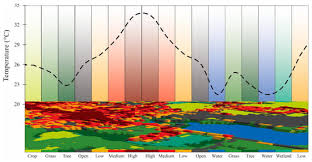
Thermal Remote Sensing and Heat Island Analysis Training Course
Thermal Remote Sensing & Heat Island Analysis Training Course provides a comprehensive understanding of Thermal Remote Sensing principles and their application in Urban Heat Island (UHI) analysis.
Thermal Remote Sensing & Heat Island Analysis Training Course provides a comprehensive understanding of Thermal Remote Sensing principles and their application in Urban Heat Island (UHI) analysis.
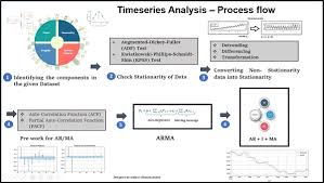
Time-Series Analysis of Geospatial Data Training Course
This program emphasizes a hands-on learning approach, leveraging cutting-edge GIS software and Time-Series Analysis of Geospatial Data Training Course programming tools to analyze real-world satellite imagery, sensor data, and other geolocated time-series data.
This program emphasizes a hands-on learning approach, leveraging cutting-edge GIS software and Time-Series Analysis of Geospatial Data Training Course programming tools to analyze real-world satellite imagery, sensor data, and other geolocated time-series data.
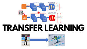
Transfer Learning in Geospatial Deep Learning Training Course
Transfer Learning in Geospatial Deep Learning Training Course emphasizes practical implementation and real-world problem-solving in areas such as environmental monitoring, urban planning, disaster management, and resource optimization.
Transfer Learning in Geospatial Deep Learning Training Course emphasizes practical implementation and real-world problem-solving in areas such as environmental monitoring, urban planning, disaster management, and resource optimization.
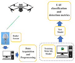
UAV-Based Lidar Systems and Data Fusion Training Course
UAV-Based Lidar Systems and Data Fusion Training Course offers an immersive experience into the cutting-edge world of UAV-based LiDAR systems and data fusion techniques
UAV-Based Lidar Systems and Data Fusion Training Course offers an immersive experience into the cutting-edge world of UAV-based LiDAR systems and data fusion techniques
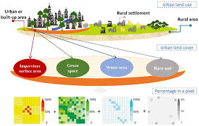
Urban Remote Sensing and Impervious Surface Mapping Training Course
Urban Remote Sensing and Impervious Surface Mapping Training Course provides a comprehensive deep dive into Urban Remote Sensing and Impervious Surface Mapping, critical disciplines for sustainable urban development and environmental management
Urban Remote Sensing and Impervious Surface Mapping Training Course provides a comprehensive deep dive into Urban Remote Sensing and Impervious Surface Mapping, critical disciplines for sustainable urban development and environmental management
Explore Other Categories
Discover more training opportunities in related fields.
Have questions about GIS?
Send us an enquiry and we’ll get back to you within 24 hours.