Training Course on Integrating TensorFlow/PyTorch with GIS Platforms
Training Course on Integrating TensorFlow/PyTorch with GIS Platforms provides a deep dive into integrating cutting-edge deep learning frameworks like TensorFlow and PyTorch with powerful GIS platforms.
Course Overview
Training Course on Integrating TensorFlow/PyTorch with GIS Platforms
Introduction
In the rapidly evolving landscape of data science and geospatial intelligence, the convergence of Artificial Intelligence (AI) and Geographic Information Systems (GIS) is unlocking unprecedented capabilities. Training Course on Integrating TensorFlow/PyTorch with GIS Platforms provides a deep dive into integrating cutting-edge deep learning frameworks like TensorFlow and PyTorch with powerful GIS platforms. Participants will gain the practical skills to leverage spatial data analysis, machine learning for geospatial applications, and advanced AI models to extract actionable insights from complex geographical datasets. This program is crucial for professionals seeking to lead innovation in GeoAI, predictive mapping, and smart urban planning.
The exponential growth of big spatial data necessitates advanced analytical techniques. This course addresses the critical demand for professionals proficient in geospatial deep learning and AI-driven GIS, empowering them to develop intelligent solutions for real-world challenges. From environmental monitoring to disaster management and resource optimization, the integration of TensorFlow/PyTorch with GIS platforms transforms raw data into strategic intelligence, fostering data-driven decision-making and enhanced spatial analytics.
Course Duration
10 days
Course Objectives
- Understand core concepts of deep learning (CNNs, RNNs, Transformers) applied to spatial data.
- Seamlessly connect TensorFlow and PyTorch with leading GIS software and libraries.
- Acquire skills in preparing, cleaning, and transforming diverse geospatial datasets for AI models.
- Learn to extract meaningful spatial features to enhance model performance.
- Build, train, and validate tailored neural networks for specific geospatial tasks.
- Utilize deep learning for object detection, image classification, and segmentation in remote sensing data.
- Analyze sequential spatial data for forecasting and change detection.
- Implement strategies for efficient training and inference with big spatial data.
- Learn to integrate trained models for real-time spatial predictions and analytics.
- Effectively communicate complex model outputs through interactive maps and dashboards.
- Explore scalable solutions for processing and deploying geospatial AI models.
- Understand the responsible development and deployment of AI in GIS.
- Apply learned techniques to practical case studies across various industries.
Organizational Benefits
- Leverage deeper spatial insights for more informed strategic planning and operational efficiency.
- Drastically reduce manual effort and accelerate data processing for large-scale spatial datasets.
- Develop accurate forecasting models for environmental changes, resource needs, and risk assessment.
- Utilize AI-driven spatial intelligence to streamline logistics, urban planning, and infrastructure management.
- Foster a culture of advanced analytics, leading to new product development and service offerings.
- Optimize operations and mitigate risks through proactive insights derived from integrated AI and GIS.
- Unlock hidden patterns and relationships within existing geospatial data, maximizing its utility.
- Position the organization at the forefront of geospatial technology and AI innovation.
Target Audience
- GIS Professionals & Analysts
- Data Scientists & Machine Learning Engineers.
- Urban Planners & Civil Engineers
- Environmental Scientists & Conservationists.
- Remote Sensing Specialists analysis.
- Researchers & Academics.
- Software Developers.
- Anyone with a foundational understanding of GIS and Python.
Course Outline
Module 1: Introduction to GeoAI and the Convergence of GIS & Deep Learning
- Understanding the paradigm shift: GIS meets AI/ML/DL.
- Overview of TensorFlow and PyTorch for spatial data.
- Setting up the GeoAI development environment
- Key concepts: Geospatial data types, raster vs. vector, spatial relationships.
- Case Study: Analyzing urban sprawl using historical satellite imagery with introductory deep learning concepts.
Module 2: Geospatial Data Acquisition and Preprocessing for AI
- Sources of geospatial data: Satellite imagery, LiDAR, aerial photos, open street map data.
- Data formats: GeoTIFF, NetCDF, Shapefile, GeoJSON, etc.
- Advanced data cleaning and transformation techniques for spatial datasets.
- Georeferencing, projection handling, and spatial resampling.
- Case Study: Preparing Sentinel-2 satellite images for land cover classification, including atmospheric correction and cloud masking.
Module 3: Fundamentals of Deep Learning with TensorFlow and Keras
- Neural network architectures: Perceptrons, activation functions, loss functions.
- Introduction to TensorFlow and Keras for building deep learning models.
- Training neural networks: Forward and backward propagation, optimization algorithms.
- TensorBoard for model visualization and debugging.
- Case Study: Building a simple neural network in TensorFlow/Keras to predict property values based on spatial features (e.g., proximity to amenities).
Module 4: Convolutional Neural Networks (CNNs) for Image-Based GIS
- CNN architecture: Convolutional layers, pooling layers, fully connected layers.
- Applying CNNs to geospatial imagery for feature extraction.
- Image classification and segmentation using TensorFlow/Keras.
- Transfer learning and fine-tuning pre-trained models (e.g., ResNet, VGG).
- Case Study: Detecting illegal deforestation in the Amazon rainforest using CNNs on high-resolution satellite imagery.
Module 5: Deep Learning with PyTorch for Spatial Data
- Introduction to PyTorch: Tensors, autograd, dynamic computational graphs.
- Building and training custom neural networks in PyTorch.
- PyTorch DataLoader and Dataset for efficient spatial data handling.
- Comparison of TensorFlow and PyTorch for geospatial applications.
- Case Study: Implementing a semantic segmentation model in PyTorch for urban land use mapping from aerial photographs.
Module 6: Object Detection and Instance Segmentation in Geospatial Contexts
- Object detection algorithms: YOLO, SSD, Faster R-CNN.
- Applying object detection to identify features in satellite and drone imagery.
- Instance segmentation for precise object delineation.
- Training and evaluating object detection models for geospatial data.
- Case Study: Identifying and counting vehicles in parking lots from satellite images for traffic analysis or urban planning.
Module 7: Recurrent Neural Networks (RNNs) for Time-Series Geospatial Data
- Understanding sequential data and the need for RNNs.
- Architectures: LSTMs, GRUs for processing time-series geospatial data.
- Forecasting spatial phenomena: Climate trends, urban growth, disaster progression.
- Preparing and aligning time-series geospatial datasets.
- Case Study: Predicting the spread of wildfires or disease outbreaks using historical spatial-temporal data and RNNs.
Module 8: Geospatial Feature Engineering and Spatial Graph Neural Networks
- Advanced feature engineering for spatial datasets (e.g., spatial autocorrelation, proximity analysis).
- Introduction to Graph Neural Networks (GNNs) for non-Euclidean spatial data.
- Building and training GNNs for network analysis and spatial relationships.
- Representing geographic networks as graphs.
- Case Study: Optimizing logistics routes or identifying critical infrastructure vulnerabilities using GNNs on road networks.
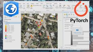
Module 9: Integrating AI Models with GIS Platforms (ArcGIS/QGIS)
- Utilizing Python APIs for GIS platforms (ArcPy for ArcGIS, PyQGIS for QGIS).
- Exporting and importing data between deep learning frameworks and GIS.
- Scripting automated GeoAI workflows within GIS environments.
- Visualizing AI model outputs directly on maps.
- Case Study: Developing a Python script to automate the classification of land cover using a trained TensorFlow model within ArcGIS Pro.
Module 10: Cloud-Based GeoAI and Scalability
- Leveraging cloud computing platforms (AWS, Google Cloud, Azure) for GeoAI.
- Distributed training of deep learning models for massive datasets.
- Containerization (Docker) and orchestration (Kubernetes) for GeoAI deployment.
- Utilizing cloud-based GIS services (e.g., Google Earth Engine, ESRI ArcGIS Online).
- Case Study: Training a large-scale land cover classification model on Google Earth Engine with TensorFlow.
Module 11: Interpretability and Explainable AI (XAI) in GIS
- Understanding model black boxes and the need for interpretability.
- Techniques for explaining deep learning predictions in a spatial context (e.g., SHAP, LIME).
- Visualizing attention maps and feature activations in geospatial CNNs.
- Ethical considerations and bias detection in GeoAI models.
- Case Study: Explaining the factors influencing an AI model's prediction of flood risk in a specific urban area.
Module 12: Real-time Geospatial AI and Edge Computing
- Concepts of real-time spatial data streams
- Deploying lightweight AI models for edge devices
- Optimizing models for low-latency inference in geospatial applications.
- Stream processing frameworks for continuous spatial analysis.
- Case Study: Implementing a real-time object detection system on a drone for agricultural field monitoring using TensorFlow Lite.
Module 13: Advanced Topics: Generative Models and Reinforcement Learning for GIS
- Generative Adversarial Networks (GANs) for synthetic geospatial data generation.
- Applications of GANs in super-resolution or data augmentation for GIS.
- Introduction to Reinforcement Learning (RL) for spatial decision-making.
- RL applications in dynamic resource allocation or autonomous navigation.
- Case Study: Generating realistic synthetic satellite imagery for training purposes using GANs.
Module 14: GeoAI Project Design and Implementation
- Defining GeoAI project scopes, objectives, and success metrics.
- Data collection strategies and annotation for deep learning.
- Model selection, training pipelines, and hyperparameter tuning.
- Evaluation metrics specific to geospatial AI tasks.
- Case Study: Group project: Designing and prototyping a GeoAI solution for a chosen real-world problem (e.g., optimizing emergency response, predicting crop yield).
Module 15: Future Trends, Ethical AI, and Career Paths in GeoAI
- Emerging trends: Foundation models, self-supervised learning in geospatial AI.
- Ethical implications of AI in surveillance, privacy, and decision-making.
- Best practices for responsible GeoAI development and deployment.
- Career opportunities and industry outlook in the GeoAI domain.
- Case Study: Discussion on the ethical challenges and potential biases in using AI for predictive policing in urban environments.
Training Methodology
Our training methodology is hands-on, project-based, and highly interactive, ensuring participants gain practical expertise.
- Instructor-Led Sessions: Expert-led lectures covering theoretical concepts and practical applications.
- Live Coding Demonstrations: Step-by-step walkthroughs of code implementation for various GeoAI tasks.
- Practical Labs & Exercises: Intensive hands-on exercises designed to reinforce learning and build proficiency.
- Real-World Case Studies: In-depth analysis and implementation of solutions to industry-relevant problems.
- Mini-Projects & Final Project: Participants will apply learned concepts to develop end-to-end GeoAI solutions.
- Interactive Q&A and Discussions: Fostering a collaborative learning environment.
- Resource Sharing: Access to comprehensive course materials, code repositories, and curated readings.
- Peer-to-Peer Learning: Encouraging collaboration and knowledge exchange among participants.
Register as a group from 3 participants for a Discount
Send us an email: info@datastatresearch.org or call +254724527104
Certification
Upon successful completion of this training, participants will be issued with a globally- recognized certificate.
Tailor-Made Course
We also offer tailor-made courses based on your needs.
Key Notes
a. The participant must be conversant with English.
b. Upon completion of training the participant will be issued with an Authorized Training Certificate
c. Course duration is flexible and the contents can be modified to fit any number of days.
d. The course fee includes facilitation training materials, 2 coffee breaks, buffet lunch and A Certificate upon successful completion of Training.
e. One-year post-training support Consultation and Coaching provided after the course.
f. Payment should be done at least a week before commence of the training, to DATASTAT CONSULTANCY LTD account, as indicated in the invoice so as to enable us prepare better for you.