Training Course on Advanced Geoprocessing and Automation with GIS
Training Course on Advanced Geoprocessing and Automation with GIS delves into the transformative power of Advanced Geoprocessing and GIS Automation, equipping professionals with cutting-edge skills to streamline geospatial workflows and unlock deeper insights from spatial data.
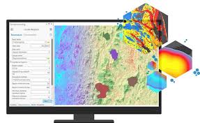
Course Overview
Training Course on Advanced Geoprocessing and Automation with GIS
Introduction
Training Course on Advanced Geoprocessing and Automation with GIS delves into the transformative power of Advanced Geoprocessing and GIS Automation, equipping professionals with cutting-edge skills to streamline geospatial workflows and unlock deeper insights from spatial data. In today's data-driven world, the ability to efficiently process, analyze, and automate complex geographic tasks is paramount for informed decision-making and operational efficiency across diverse sectors. This course goes beyond fundamental GIS concepts, focusing on scripting with Python (ArcPy, QGIS PyQGIS), ModelBuilder, and FME to empower participants to build robust, repeatable, and scalable solutions for real-world geospatial challenges.
The curriculum emphasizes hands-on application and practical problem-solving, enabling participants to develop custom tools, automate repetitive analyses, integrate disparate data sources, and deploy sophisticated spatial models. By mastering these advanced techniques, professionals will not only enhance their individual productivity but also drive significant organizational benefits through reduced manual effort, improved data consistency, and accelerated spatial analysis capabilities. This training is crucial for anyone looking to leverage the full potential of Geographic Information Systems for smart cities, environmental monitoring, resource management, logistics optimization, and disaster response.
Course Duration
10 days
Course Objectives
Upon completion of this course, participants will be able to:
- Master advanced spatial analysis techniques for complex problem-solving.
- Automate repetitive GIS tasks using Python scripting (ArcPy, PyQGIS) for maximum efficiency.
- Design and implement geoprocessing models with ModelBuilder for repeatable workflows.
- Integrate and transform diverse geospatial data using FME (Feature Manipulation Engine) for seamless data pipelines.
- Develop custom geoprocessing tools and scripts to extend GIS software functionality.
- Perform batch processing of large spatial datasets for enhanced productivity.
- Apply geostatistical analysis and interpolation methods for data prediction and surface generation.
- Implement advanced raster analysis for environmental modeling and suitability assessment.
- Utilize network analysis tools for optimized routing, logistics, and accessibility studies.
- Develop web geoprocessing services for scalable and accessible spatial analysis.
- Troubleshoot and debug GIS scripts and models effectively.
- Leverage cloud GIS platforms for scalable geoprocessing and data management.
- Apply machine learning and AI in GIS for predictive spatial analytics.
Organizational Benefits
- Automating routine GIS tasks frees up valuable staff time, allowing them to focus on more complex analytical and strategic initiatives.
- Automated workflows reduce human error, leading to more accurate and reliable spatial data and analysis results.
- Rapid processing of spatial data and generation of insights enables quicker and more informed decisions.
- Minimizing manual effort and optimizing resource utilization leads to significant operational cost savings.
- Empowering staff with advanced skills fosters a culture of innovation and problem-solving using cutting-edge geospatial technologies.
- Automated processes can be easily scaled to handle larger datasets and more complex analyses, adapting to evolving organizational needs.
- Organizations with strong GIS automation capabilities gain a competitive edge by leveraging spatial intelligence more effectively.
- Optimized workflows lead to more efficient allocation and utilization of geographic data and human resources.
Target Audience
- GIS Analysts and SpecialistsGeospatial Developers
- Data Scientists
- Urban Planners and Consultants.
- Environmental Scientists and Researchers.
- Engineers and Infrastructure Managers.
- Resource Managers.
- Anyone with foundational GIS knowledge.
Course Outline
Module 1: Introduction to Advanced Geoprocessing Concepts
- Beyond Basic Tools
- Geoprocessing Frameworks
- Data Models for Automation.
- Introduction to Scriptin.
- Performance Optimization.
- Case Study: Automating daily satellite imagery processing for agricultural yield prediction, reducing manual effort by 80%.
Module 2: Python Fundamentals for GIS Automation
- Python Syntax and Data Types.
- Working with Libraries.
- Error Handling and Debugging.
- Functions and Modules.
- Jupyter Notebooks for GIS.
- Case Study: Developing a Python script to automatically rename and organize incoming shapefiles based on their metadata attributes.
Module 3: Automating Geoprocessing with ArcPy
- ArcPy Environment Setup.
- Accessing Geoprocessing Tools.
- Working with Cursors.
- Scripting Geodatabase Management.
- Custom Toolboxes and Script Tools.
- Case Study: Automating the generation of fire hazard maps for an urban area, including buffering, intersecting, and reclassifying features using ArcPy
Module 4: Automating Geoprocessing with PyQGIS (for QGIS Users)
- PyQGIS Environment Setup.
- QGIS Processing Algorithms
- Working with Layers and Features
- Map Canvas and QGIS Projects.
- Creating Custom QGIS Plugins.
- Case Study: Building a PyQGIS script to automate landslide susceptibility mapping by combining elevation, slope, and land cover layers.
Module 5: ModelBuilder for Visual Workflow Automation
- Introduction to ModelBuilder.
- Variables and Connectors
- Iterators and Logic.
- Integrating Scripts in Models.
- Sharing and Documenting Models.
- Case Study: Creating a ModelBuilder workflow to identify optimal sites for new solar farms based on solar radiation, slope, and proximity to power lines.
Module 6: Advanced Data Integration with FME Desktop
- FME Workbench Basics.
- Data Transformation Techniques.
- Handling Diverse Data Formats.
- Conditional Processing and Filtering.
- Error Handling and Logging in FME.
- Case Study: Integrating disparate municipal datasets (parcels from CAD, zoning from shapefiles, utility networks from geodatabases) into a unified urban planning database using FME.
Module 7: Spatial Statistics and Geostatistical Analysis Automation
- Exploratory Spatial Data Analysis (ESDA).
- Spatial Autocorrelation (Moran's I).
- Interpolation Techniques.
- Hot Spot and Cluster Analysis.
- Geostatistical Model Validation
- Case Study: Automating the prediction of air pollution levels across a city using sparse sensor data and historical trends with geostatistical models.
Module 8: Advanced Raster Geoprocessing and Automation
- Raster Algebra and Map Calculator.
- Hydrologic Modeling.
- Terrain Analysis.
- Suitability Modeling.
- Image Classification and Segmentation
- Case Study: Automating the identification of suitable areas for reforestation based on elevation, soil type, and proximity to water sources
Module 9: Network Analysis Automation
- Creating Network Datasets.
- Routing and Closest Facility Analysis.
- Location-Allocation Problems.
- OD Cost Matrix Analysis.
- Public Transit Network Analysis.
- Case Study: Automating the optimization of delivery routes for a logistics company, considering traffic, road closures, and vehicle capacity.
Module 10: Advanced Data Management and Quality Control
- Automated Geodatabase Design.
- Topology Rules and Validation.
- Versioned Editing and Reconciliatio.
- Data QA/QC Automation.
- Metadata Management.
- Case Study: Developing an automated script to check for topological errors (e.g., overlapping polygons, gaps) in a land parcel dataset and flag inconsistencies.
Module 11: Web Geoprocessing and Cloud Integration
- Publishing Geoprocessing Services.
- Consuming Web Services in Scripts.
- Cloud Platforms for GIS.
- Serverless Geoprocessing.
- API Integration.
- Case Study: Building a web application that allows users to perform a custom flood risk assessment by submitting an address, triggering a cloud-based geoprocessing service.
Module 12: Big Data Geoprocessing
- Introduction to Big Data GIS.
- Distributed Geoprocessing.
- Cloud Data Warehouses
- Geospatial Databases.
- Parallel Processing in GIS.
- Case Study: Analyzing billions of GPS points from connected vehicles to identify traffic congestion hotspots and optimize traffic signal timing.
Module 13: Integrating GIS with Machine Learning
- Spatial Feature Engineering.
- Supervised Learning in GIS.
- Unsupervised Learning in GIS.
- Deep Learning for Geospatial Data