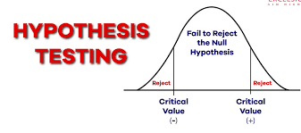
Hypothesis Testing in Spatial Data Analysis Training Course
Hypothesis Testing in Spatial Data Analysis Training Course provides a comprehensive deep dive into Hypothesis Testing in Spatial Data Analysis, empowering participants with the essential geospatial analytical skills to draw statistically sound conclusions from location-based data.
Course Overview
Hypothesis Testing in Spatial Data Analysis Training Course
Introduction
Hypothesis Testing in Spatial Data Analysis Training Course provides a comprehensive deep dive into Hypothesis Testing in Spatial Data Analysis, empowering participants with the essential geospatial analytical skills to draw statistically sound conclusions from location-based data. In an increasingly data-driven world, the ability to rigorously test spatial patterns, relationships, and trends is paramount for informed decision-making across diverse sectors like urban planning, environmental science, public health, and business intelligence. This course bridges the gap between theoretical statistical concepts and their practical application within a Geographic Information Systems (GIS) framework, focusing on robust methodologies for spatial inference and model validation.
Participants will gain hands-on experience with cutting-edge spatial statistics software and techniques, learning to formulate testable hypotheses, select appropriate spatial statistical tests, interpret p-values in a spatial context, and effectively communicate findings. From spatial autocorrelation and point pattern analysis to geographically weighted regression and spatial prediction, the curriculum is designed to equip professionals with the advanced analytical toolkit necessary to uncover hidden insights, assess the significance of observed spatial phenomena, and drive evidence-based strategies. This training emphasizes real-world case studies and practical exercises, ensuring immediate applicability of learned concepts in various professional domains.
Course Duration
5 days
Course Objectives
- Develop well-defined, testable hypotheses specifically tailored for spatial datasets.
- Grasp the unique characteristics of spatial data, including spatial dependence and heterogeneity, and their implications for statistical inference.
- Utilize ESDA techniques to visualize and identify initial spatial patterns and potential anomalies.
- Calculate and interpret global and local spatial autocorrelation statistics (e.g., Moran's I, Getis-Ord Gi*) to assess clustering and dispersion.
- Conduct hypothesis tests for point patterns, differentiating between random, clustered, and dispersed distributions.
- Build and evaluate spatial regression models (e.g., Spatial Lag, Spatial Error) to account for spatial effects in relationships between variables.
- Apply geostatistical methods like kriging and interpolation for spatial prediction and uncertainty quantification.
- Critically evaluate the assumptions underlying various spatial statistical tests and models.
- Understand the nuances of p-value interpretation in the context of spatial data and multiple comparisons.
- Present and visualize the results of spatial hypothesis tests in a clear, concise, and compelling manner.
- Become proficient in using GIS software (e.g., QGIS, ArcGIS) and statistical programming languages (e.g., R, Python) for spatial analysis.
- Understand and mitigate the impact of MAUP on spatial analysis results.
- Gain the ability to translate complex spatial questions into testable hypotheses and derive actionable insights.
Organizational Benefits
- Equip teams with the ability to move beyond visual inspection to statistically validate spatial patterns, leading to more robust and defensible decisions in resource allocation, risk assessment, market analysis, and public policy formulation.
- Improve efficiency in urban planning, logistics optimization, and environmental monitoring by accurately identifying areas of significant spatial trends or anomalies.
- Leverage advanced spatial modeling to enhance forecasting and predictive analytics for future spatial phenomena, such as disease outbreaks or land-use changes.
- Identify and quantify spatial risks more precisely, leading to better strategies for disaster preparedness, public health interventions, and crime analysis.
- Develop in-house expertise in cutting-edge spatial analytical techniques, providing a significant edge in fields requiring advanced geospatial intelligence and location analytics.
- Support the creation of policies and interventions grounded in rigorous spatial evidence, increasing their effectiveness and accountability.
Target Audience
- GIS Professionals & Analysts.
- Urban Planners & Demographers.
- Environmental Scientists & Ecologists.
- Public Health Researchers & Epidemiologists.
- Market Researchers & Business Analysts.
- Data Scientists & Statisticians.
- Government & NGO Researchers.
- Academics & Graduate Students.
Course Outline
Module 1: Foundations of Spatial Data and Hypothesis Testing
- Understanding Spatial Data Types.
- Introduction to Spatial Concepts
- Review of Statistical Hypothesis Testing.
- Software Introduction.
- Case Study: Identifying Spatial Outliers in Crime Data: Applying basic descriptive statistics and initial visualizations to identify unusual crime clusters.
Module 2: Exploratory Spatial Data Analysis (ESDA)
- Spatial Data Visualization Techniques
- Spatial Measures of Central Tendency and Dispersion
- Spatial Distribution Analysis.
- Introduction to Spatial Weights Matrices.
- Case Study: Visualizing Income Disparities in Urban Areas: Using ESDA to uncover initial spatial patterns of income and identify potential areas for intervention.
Module 3: Global Spatial Autocorrelation
- Concept of Spatial Autocorrelation
- Moran's I Statistic
- Geary's C Statistic.
- Monte Carlo Simulation for Significance Testing.
- Case Study: Analyzing the Global Clustering of a Disease Outbreak: Using global Moran's I to determine if disease incidence exhibits a significant spatial pattern.
Module 4: Local Spatial Autocorrelation and Hot Spot Analysis
- Local Indicators of Spatial Association (LISA).
- Local Moran's I: Calculating and mapping local Moran's I for identifying hot spots and cold spots.
- Getis-Ord Gi Statistic:* Hot spot analysis using Getis-Ord Gi* for identifying statistically significant clusters of high or low values.
- Cluster and Outlier Analysis (Anselin Local Moran's I)
- Case Study: Identifying Hot Spots of Traffic Accidents: Pinpointing areas with a statistically significant high concentration of accidents to inform safety measures.
Module 5: Point Pattern Analysis and Hypothesis Testing
- Types of Point Patterns.
- Nearest Neighbor Analysis
- K-function and L-function
- Ripley's K-function and Besag's L-function
- Case Study: Assessing the Distribution of Invasive Species: Determining if invasive plant occurrences are randomly distributed or show clustering patterns.
Module 6: Spatial Regression Models
- Limitations of OLS Regression with Spatial Data
- Spatial Lag Model (SAR).
- Spatial Error Model (SEM).
- Geographically Weighted Regression (GWR)
- Case Study: Modeling Housing Prices with Spatial Effects: Applying spatial regression to understand factors influencing housing values while accounting for neighborhood effects.
Module 7: Geostatistics and Spatial Prediction
- Variography.
- Kriging Techniques:.
- Cross-Validation and Model Assessment.
- Spatial Prediction and Mapping Uncertainty.
- Case Study: Predicting Soil Contamination Levels: Using kriging to estimate contamination across an area and map areas exceeding regulatory thresholds.
Module 8: Advanced Topics and Practical Applications
- Spatial Filtering and Decomposition.
- Spatial Interaction Model.
- Integrating Machine Learning with Spatial Data.
- Best Practices for Spatial Analysis Workflow
- Case Study: Optimizing Emergency Service Response Times: Applying various spatial analysis techniques to identify optimal locations for new emergency service facilities.
Training Methodology
This training course employs a highly interactive and hands-on methodology to maximize learning and practical skill development.
- Lectures and Discussions: Concise theoretical explanations of key concepts, followed by open discussions to foster understanding.
- Software Demonstrations: Live demonstrations of spatial analysis techniques using industry-standard GIS software (QGIS, ArcGIS) and open-source statistical programming environments (RStudio, Jupyter Notebook with Python libraries like GeoPandas, PySAL).
- Practical Exercises: Extensive hands-on exercises for each module, allowing participants to apply learned concepts immediately using real-world spatial datasets.
- Case Studies: In-depth analysis of diverse real-world case studies to illustrate the application of hypothesis testing in various domains.
- Group Activities & Problem-Solving: Collaborative exercises encouraging participants to work together on spatial challenges.
- Q&A Sessions: Dedicated time for addressing participant questions and clarifying complex topics.
- Project-Based Learning (Optional): Participants can work on a mini-project using their own data or provided datasets, applying the full analytical workflow.
Register as a group from 3 participants for a Discount
Send us an email: info@datastatresearch.org or call +254724527104
Certification
Upon successful completion of this training, participants will be issued with a globally- recognized certificate.
Tailor-Made Course
We also offer tailor-made courses based on your needs.
Key Notes
a. The participant must be conversant with English.
b. Upon completion of training the participant will be issued with an Authorized Training Certificate
c. Course duration is flexible and the contents can be modified to fit any number of days.
d. The course fee includes facilitation training materials, 2 coffee breaks, buffet lunch and A Certificate upon successful completion of Training.
e. One-year post-training support Consultation and Coaching provided after the course.
f. Payment should be done at least a week before commence of the training, to DATASTAT CONSULTANCY LTD account, as indicated in the invoice so as to enable us prepare better for you.