GIS for Environmental Impact Assessment (EIA) Training Course
GIS for Environmental Impact Assessment (EIA) Training Course provides professionals with the cutting-edge geospatial tools and methodologies necessary to conduct thorough, data-driven EIAs.
Course Overview
GIS for Environmental Impact Assessment (EIA) Training Course
Introduction
In an era of increasing environmental scrutiny and complex development projects, the integration of Geographic Information Systems (GIS) has become paramount for robust Environmental Impact Assessment (EIA). GIS for Environmental Impact Assessment (EIA) Training Course provides professionals with the cutting-edge geospatial tools and methodologies necessary to conduct thorough, data-driven EIAs. Participants will gain practical skills in spatial data analysis, environmental modeling, and impact prediction, enabling them to make informed decisions that promote sustainable development and regulatory compliance.
This course delves into the transformative power of geospatial technology in streamlining the EIA process, from baseline data collection to mitigation strategy development and post-project monitoring. Through hands-on exercises and real-world case studies, attendees will master techniques for visualizing environmental sensitivities, analyzing cumulative impacts, and effectively communicating complex spatial information to stakeholders. Equip yourself with the advanced GIS expertise to navigate the intricate landscape of environmental regulations and contribute to a more resilient future.
Course Duration
10 days
Course Objectives
- Master Geospatial Data Integration for comprehensive EIA baseline studies.
- Apply Remote Sensing techniques for Land Use/Land Cover (LULC) mapping and change detection in EIA contexts.
- Utilize Spatial Analysis tools for impact prediction modeling and sensitivity mapping.
- Conduct Multi-Criteria Decision Analysis (MCDA) using GIS for site suitability assessment and alternative analysis.
- Develop and manage Environmental Geodatabases for efficient EIA data organization and retrieval.
- Perform Hydrological Modeling and Flood Risk Assessment in GIS for water resource impact evaluation.
- Assess Biodiversity Impacts and delineate Protected Areas using advanced GIS techniques.
- Implement Air Quality Modeling and Noise Pollution Mapping within a GIS framework.
- Apply GIS for Social Impact Assessment (SIA), including community vulnerability mapping.
- Generate High-Quality Cartographic Outputs and Interactive Web Maps for effective EIA reporting and stakeholder engagement.
- Explore the application of AI and Machine Learning in enhancing GIS-based EIA predictions.
- Understand Legal and Policy Frameworks for EIA and how GIS supports regulatory compliance.
- Design Environmental Monitoring Plans and Post-EIA Audits using dynamic GIS dashboards.
Organizational Benefits
- Facilitates data-driven decisions through comprehensive spatial analysis, leading to more robust and defensible EIAs.
- Streamlines data collection, processing, and analysis, reducing time and resources spent on EIA studies.
- Enables proactive identification and mitigation of potential environmental impacts, minimizing liabilities and promoting sustainable practices.
- Ensures adherence to national and international environmental regulations through systematic and transparent assessment processes.
- Provides powerful visualization tools for communicating complex environmental information, fostering greater understanding and collaboration with stakeholders.
- Supports intelligent planning and allocation of resources by identifying environmental sensitivities and carrying capacities.
- Equips organizations with advanced capabilities in environmental assessment, setting them apart in a sustainability-focused market.
- Creates centralized, easily accessible environmental datasets for future reference and long-term monitoring.
Target Audience
- Environmental Consultants & Practitioners
- EIA Project Managers & Coordinators
- Government Agency Staff (Environmental Ministries, Planning Departments)
- Urban & Regional Planners
- Researchers & Academics in Environmental Science, Geography, and related fields
- Sustainability Professionals
- Engineers & Developers involved in infrastructure projects
- NGO and Community Development Workers focused on environmental protection
Course Outline
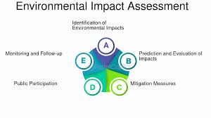
Module 1: Introduction to EIA and GIS Fundamentals
- Understanding the EIA process: Screening, Scoping, Impact Prediction, Mitigation, Monitoring.
- Overview of GIS: Concepts, Components (Hardware, Software, Data, People, Methods).
- Importance of spatial data in environmental decision-making.
- Introduction to popular GIS software platforms (e.g., ArcGIS Pro, QGIS).
- Case Study: Analyzing the EIA requirements for a proposed road expansion project and identifying initial spatial data needs.
Module 2: Geospatial Data Acquisition and Management
- Sources of GIS data for EIA: Satellite imagery, aerial photos, LiDAR, GPS, existing databases.
- Data formats: Vector (points, lines, polygons) and Raster (gridded data).
- Georeferencing and Coordinate Systems: Ensuring spatial accuracy.
- Designing and creating environmental geodatabases.
- Case Study: Collecting and integrating disparate data sources (topography, land parcels, ecological surveys) for an agricultural development EIA.
Module 3: Remote Sensing for Environmental Baseline Studies
- Principles of Remote Sensing: Electromagnetic spectrum, sensors, platforms.
- Image interpretation and classification techniques (supervised, unsupervised).
- Deriving Land Use/Land Cover (LULC) maps from satellite imagery.
- Change detection analysis for assessing environmental trends.
- Case Study: Using time-series satellite imagery to map deforestation and habitat loss around a mining concession for an EIA.
Module 4: Spatial Analysis for Impact Identification
- Overlay Analysis: Combining multiple environmental layers to identify sensitive areas.
- Buffering: Delineating impact zones around project components.
- Proximity analysis: Assessing distances to critical resources or communities.
- Network analysis for assessing connectivity and flow (e.g., pollution pathways).
- Case Study: Applying buffer and overlay analysis to identify potential impacts of a new industrial facility on nearby wetlands and residential areas.
Module 5: Environmental Sensitivity Mapping
- Defining environmental sensitivity criteria and indicators.
- Weighting and scoring methods for combining sensitivity layers.
- Creating composite environmental sensitivity maps.
- Identifying "no-go" zones and areas requiring special mitigation.
- Case Study: Developing a sensitivity map for a coastal development project, integrating data on marine ecosystems, cultural heritage sites, and tourism zones.
Module 6: Hydrological & Water Quality Impact Assessment
- Delineating watersheds and stream networks using Digital Elevation Models (DEMs).
- Modeling surface runoff and erosion potential.
- Assessing impacts on water quality from point and non-point sources.
- Mapping flood plains and flood risk areas.
- Case Study: Simulating the impact of a dam construction project on downstream river flow and water availability for local communities and ecosystems.
Module 7: Ecological & Biodiversity Impact Assessment
- Mapping habitat types and ecological corridors.
- Analyzing habitat fragmentation and connectivity.
- Identifying critical habitats for endangered species.
- Assessing cumulative impacts on regional biodiversity.
- Case Study: Using GIS to map and quantify potential habitat loss for a protected bird species due to a proposed wind farm development.
Module 8: Air Quality and Noise Pollution Modeling
- Sources and dispersion of air pollutants.
- Integrating air quality monitoring data with spatial models.
- Mapping noise contours from transportation or industrial activities.
- Assessing population exposure to pollution.
- Case Study: Modeling the dispersion of particulate matter from a new factory and visualizing affected areas using GIS.
Module 9: Social and Cultural Impact Assessment
- Mapping demographic data and community infrastructure.
- Assessing impacts on livelihoods, traditional land use, and cultural heritage.
- Identifying vulnerable populations and displacement risks.
- Participatory GIS (PGIS) for community engagement.
- Case Study: Analyzing the social impacts of a large-scale agricultural project on indigenous communities' access to resources and traditional lands.
Module 10: Cumulative Impact Assessment (CIA)
- Understanding the concept and importance of CIA.
- Methods for identifying past, present, and reasonably foreseeable future actions.
- Spatial approaches to combining individual project impacts.
- Assessing synergistic and antagonistic effects.
- Case Study: Conducting a CIA for multiple mining projects in a region, evaluating their combined impacts on water resources and air quality.
Module 11: GIS for Mitigation and Management Planning
- Developing spatially explicit mitigation measures.
- Identifying optimal locations for compensation or offset projects.
- Designing Environmental Management Plans (EMPs) within GIS.
- Mapping monitoring points and adaptive management zones.
- Case Study: Delineating alternative routes for a pipeline project to minimize environmental disturbance and avoid sensitive habitats.
Module 12: EIA Report Generation and Visualization
- Principles of effective cartographic design for EIA maps.
- Creating professional and compelling maps and figures for reports.
- Developing interactive web maps and dashboards for public disclosure.
- Data visualization techniques for communicating complex spatial information.
- Case Study: Designing a series of interactive maps and charts for an EIA report on a proposed tourism resort, highlighting key impacts and mitigation efforts.
Module 13: Legal Frameworks and Regulatory Compliance with GIS
- Understanding national and international EIA legislation.
- Using GIS to track compliance with environmental permits and conditions.
- Automating compliance checks and reporting.
- GIS as evidence in environmental legal proceedings.
- Case Study: Demonstrating how GIS can be used to prove compliance with a land reclamation plan by comparing pre- and post-project satellite imagery.
Module 14: Advanced GIS Techniques and Emerging Technologies
- Introduction to 3D GIS for visualizing terrain and infrastructure.
- Drone data capture and processing for high-resolution environmental mapping.
- Integration of AI and Machine Learning for predictive modeling (e.g., species distribution modeling).
- Real-time monitoring with IoT and GIS.
- Case Study: Using drone imagery and AI-powered object detection to assess the extent of illegal logging in a forest concession.
Module 15: GIS for Post-EIA Monitoring and Auditing
- Designing spatial monitoring networks.
- Using GIS for tracking environmental parameters over time.
- Conducting environmental audits with spatial data.
- Developing adaptive management strategies based on monitoring results.
- Case Study: Implementing a long-term environmental monitoring program for a hydroelectric power plant using GIS to track water quality, reservoir levels, and downstream ecological health.
Training Methodology
This training course employs a blended learning approach, combining:
- Interactive Lectures: Engaging presentations on core concepts and theoretical foundations.
- Hands-on Software Exercises: Practical sessions using industry-standard GIS software (e.g., ArcGIS Pro, QGIS) to reinforce learning.
- Real-World Case Studies: In-depth analysis and discussion of actual EIA projects where GIS played a crucial role.
- Group Discussions & Collaborative Activities: Fostering peer learning and diverse perspectives on environmental challenges.
- Practical Demonstrations: Live walkthroughs of complex GIS workflows and analytical techniques.
- Q&A Sessions: Dedicated time for addressing participant queries and clarifying concepts.
- Optional Project Work: Opportunity for participants to apply learned skills to a mini-EIA project.
Register as a group from 3 participants for a Discount
Send us an email: info@datastatresearch.org or call +254724527104
Certification
Upon successful completion of this training, participants will be issued with a globally- recognized certificate.
Tailor-Made Course
We also offer tailor-made courses based on your needs.
Key Notes
a. The participant must be conversant with English.
b. Upon completion of training the participant will be issued with an Authorized Training Certificate
c. Course duration is flexible and the contents can be modified to fit any number of days.
d. The course fee includes facilitation training materials, 2 coffee breaks, buffet lunch and A Certificate upon successful completion of Training.
e. One-year post-training support Consultation and Coaching provided after the course.
f. Payment should be done at least a week before commence of the training, to DATASTAT CONSULTANCY LTD account, as indicated in the invoice so as to enable us prepare better for you.