gis Courses
Comprehensive gis training programs for professionals
Comprehensive gis training programs for professionals
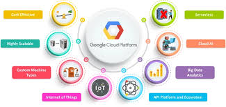
Training Course on Cloud-Native GIS Applications on Google Cloud Platform provides GIS professionals and developers with the essential skills to design, develop, and deploy scalable, high-performance Geographic Information System (GIS) applications leveraging the robust and cloud-native services offered by Google Cloud Platform (GCP).
Training Course on Cloud-Native GIS Applications on Google Cloud Platform provides GIS professionals and developers with the essential skills to design, develop, and deploy scalable, high-performance Geographic Information System (GIS) applications leveraging the robust and cloud-native services offered by Google Cloud Platform (GCP).
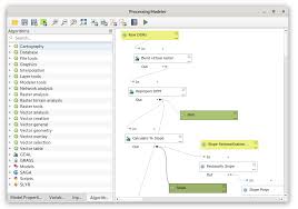
Training Course on Creating Custom Workflows with QGIS Processing Framework focuses on practical, hands-on learning, guiding participants through the intricacies of building, managing, and deploying custom workflows
Training Course on Creating Custom Workflows with QGIS Processing Framework focuses on practical, hands-on learning, guiding participants through the intricacies of building, managing, and deploying custom workflows
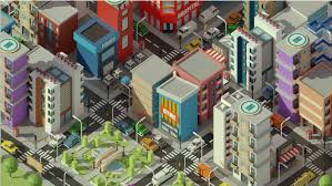
Training Course on Creating Immersive 3D City Models provides a deep dive into the cutting-edge realm of 3D city modeling, equipping participants with the essential skills and practical knowledge to design, develop, and deploy highly realistic and interactive urban environments.
Training Course on Creating Immersive 3D City Models provides a deep dive into the cutting-edge realm of 3D city modeling, equipping participants with the essential skills and practical knowledge to design, develop, and deploy highly realistic and interactive urban environments.
Training Course on Communicating Geospatial Insights Effectively focuses on bridging the gap between sophisticated geospatial analysis and impactful communication, empowering participants to transform raw spatial data into understandable stories that resonate with diverse audiences and drive tangible outcomes
Training Course on Communicating Geospatial Insights Effectively focuses on bridging the gap between sophisticated geospatial analysis and impactful communication, empowering participants to transform raw spatial data into understandable stories that resonate with diverse audiences and drive tangible outcomes
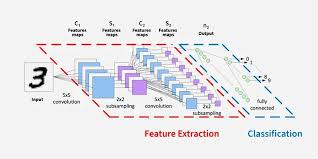
Training Course on Convolutional Neural Networks (CNNs) for Geospatial Imagery is designed to equip professionals with the practical skills and theoretical understanding necessary to leverage CNNs for advanced remote sensing image analysis.
Training Course on Convolutional Neural Networks (CNNs) for Geospatial Imagery is designed to equip professionals with the practical skills and theoretical understanding necessary to leverage CNNs for advanced remote sensing image analysis.
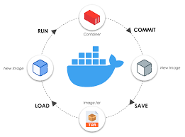
Training Course on Containerization for Web GIS Deployments provides essential knowledge and practical skills for modernizing and optimizing Web GIS infrastructure.
Training Course on Containerization for Web GIS Deployments provides essential knowledge and practical skills for modernizing and optimizing Web GIS infrastructure.
Training Course on Coastal and Marine Remote Sensing Applications outlines a specialized training course designed to equip professionals with cutting-edge remote sensing techniques for coastal and marine environment management.
Training Course on Coastal and Marine Remote Sensing Applications outlines a specialized training course designed to equip professionals with cutting-edge remote sensing techniques for coastal and marine environment management.
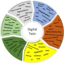
Training Course on Digital Twin Technology and Geospatial Integration delves into the convergence of real-time digital replicas with the power of geospatial intelligence, offering unprecedented insights into complex physical assets and systems.
Training Course on Digital Twin Technology and Geospatial Integration delves into the convergence of real-time digital replicas with the power of geospatial intelligence, offering unprecedented insights into complex physical assets and systems.
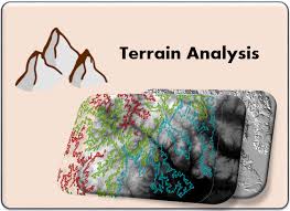
Training Course on Digital Elevation Model (DEM) and Terrain Analysis equips professionals with essential skills to leverage geospatial data for informed decision-making across diverse sectors.
Training Course on Digital Elevation Model (DEM) and Terrain Analysis equips professionals with essential skills to leverage geospatial data for informed decision-making across diverse sectors.
Training Course on Developing Interactive Story Maps is designed to empower professionals across various sectors to leverage the power of ArcGIS StoryMaps and other leading platforms to create compelling and engaging visual narratives.
Training Course on Developing Interactive Story Maps is designed to empower professionals across various sectors to leverage the power of ArcGIS StoryMaps and other leading platforms to create compelling and engaging visual narratives.
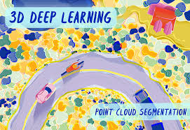
Training Course on Deep Learning for 3D Point Cloud Analysis delves into the cutting-edge domain of Deep Learning for 3D Point Cloud Analysis, equipping participants with essential skills to effectively work with complex 3D datasets generated by LiDAR, depth cameras, and other advanced sensors.
Training Course on Deep Learning for 3D Point Cloud Analysis delves into the cutting-edge domain of Deep Learning for 3D Point Cloud Analysis, equipping participants with essential skills to effectively work with complex 3D datasets generated by LiDAR, depth cameras, and other advanced sensors.
Training Course on Developing Geospatial Applications with Python and Open-Source Libraries empowers participants with the essential skills to develop robust and scalable geospatial applications using the versatile Python programming language and a suite of powerful open-source libraries
Training Course on Developing Geospatial Applications with Python and Open-Source Libraries empowers participants with the essential skills to develop robust and scalable geospatial applications using the versatile Python programming language and a suite of powerful open-source libraries