gis Courses
Comprehensive gis training programs for professionals
Comprehensive gis training programs for professionals
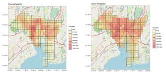
Training Course on Areal Interpolation and Spatial Aggregation Techniques delves into the theoretical foundations and practical applications of these crucial geospatial data science methodologies.
Training Course on Areal Interpolation and Spatial Aggregation Techniques delves into the theoretical foundations and practical applications of these crucial geospatial data science methodologies.
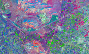
Training Course on Advance Spatial Autocorrelation Analysis is designed to equip professionals with the expertise to critically analyze spatial dependencies, identify hotspots and coldspots, and build robust geospatial models.
Training Course on Advance Spatial Autocorrelation Analysis is designed to equip professionals with the expertise to critically analyze spatial dependencies, identify hotspots and coldspots, and build robust geospatial models.
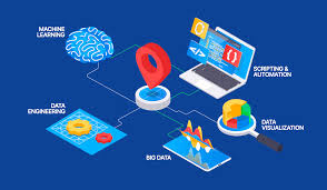
Training Course on Advanced Geoprocessing and Automation with GIS delves into the transformative power of Advanced Geoprocessing and GIS Automation, equipping professionals with cutting-edge skills to streamline geospatial workflows and unlock deeper insights from spatial data.
Training Course on Advanced Geoprocessing and Automation with GIS delves into the transformative power of Advanced Geoprocessing and GIS Automation, equipping professionals with cutting-edge skills to streamline geospatial workflows and unlock deeper insights from spatial data.
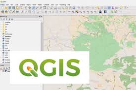
Training Course on Advanced QGIS: Custom Tools and Plugins Development is meticulously designed for GIS professionals and developers seeking to unlock the full potential of QGIS through customization and automation.
Training Course on Advanced QGIS: Custom Tools and Plugins Development is meticulously designed for GIS professionals and developers seeking to unlock the full potential of QGIS through customization and automation.
Training Course on Advanced Orthorectification and Mosaicking delves into the critical processes of Advanced Orthorectification and High-Resolution Image Mosaicking, essential for generating precise and seamless geospatial data
Training Course on Advanced Orthorectification and Mosaicking delves into the critical processes of Advanced Orthorectification and High-Resolution Image Mosaicking, essential for generating precise and seamless geospatial data
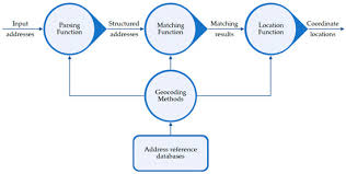
Training Course on Advanced Geocoding and Address Matching focuses on developing a deep understanding of geospatial data quality, data standardization, and the various geocoding algorithms and tools available.
Training Course on Advanced Geocoding and Address Matching focuses on developing a deep understanding of geospatial data quality, data standardization, and the various geocoding algorithms and tools available.
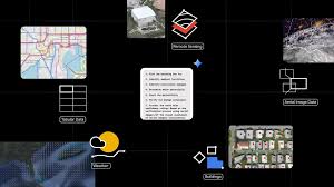
Training Course on Advanced Problem-Solving with Geospatial Data equips professionals with cutting-edge techniques and practical skills to leverage location intelligence for complex decision-making.
Training Course on Advanced Problem-Solving with Geospatial Data equips professionals with cutting-edge techniques and practical skills to leverage location intelligence for complex decision-making.
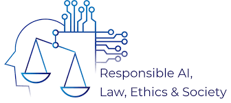
Training Course on AI Ethics and Responsible Geospatial AI delves into the critical intersection of Artificial Intelligence (AI) ethics and the rapidly evolving field of Geospatial AI.
Training Course on AI Ethics and Responsible Geospatial AI delves into the critical intersection of Artificial Intelligence (AI) ethics and the rapidly evolving field of Geospatial AI.
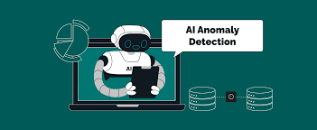
Training Course on AI for Environmental Monitoring and Anomaly Detection is designed to equip professionals with the tools and knowledge necessary to address pressing environmental challenges through data-driven insights and predictive analytics.
Training Course on AI for Environmental Monitoring and Anomaly Detection is designed to equip professionals with the tools and knowledge necessary to address pressing environmental challenges through data-driven insights and predictive analytics.
Training Course on AI for Feature Extraction from Geospatial Data delves into the transformative power of Artificial Intelligence (AI) and Machine Learning (ML) for geospatial data analysis and feature extraction
Training Course on AI for Feature Extraction from Geospatial Data delves into the transformative power of Artificial Intelligence (AI) and Machine Learning (ML) for geospatial data analysis and feature extraction
Training Course on AI for Predictive Crime Mapping provides law enforcement professionals, urban planners, and data analysts with the cutting-edge knowledge and practical skills to harness Artificial Intelligence (AI) for advanced predictive crime mapping.
Training Course on AI for Predictive Crime Mapping provides law enforcement professionals, urban planners, and data analysts with the cutting-edge knowledge and practical skills to harness Artificial Intelligence (AI) for advanced predictive crime mapping.

Training Course on Geographic Information Systems (GIS) in Public Health Disease Mapping is designed for public health professionals, epidemiologists, and researchers interested in utilizing GIS technology for disease mapping and epidemiological analysis.
Training Course on Geographic Information Systems (GIS) in Public Health Disease Mapping is designed for public health professionals, epidemiologists, and researchers interested in utilizing GIS technology for disease mapping and epidemiological analysis.