gis Courses
Comprehensive gis training programs for professionals
Comprehensive gis training programs for professionals
Training Course on Point Cloud Visualization and Analysis dives deep into cutting-edge techniques for visualizing, processing, and analyzing massive point cloud datasets, empowering professionals to extract actionable insights and create high-value deliverables.
Training Course on Point Cloud Visualization and Analysis dives deep into cutting-edge techniques for visualizing, processing, and analyzing massive point cloud datasets, empowering professionals to extract actionable insights and create high-value deliverables.
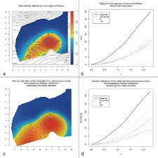
Training Course on Point Pattern Analysis and Density Estimation is designed to equip professionals with the theoretical foundations and practical skills to analyze the spatial arrangement of events, phenomena, or objects, moving beyond simple mapping to statistical inference and predictive modeling.
Training Course on Point Pattern Analysis and Density Estimation is designed to equip professionals with the theoretical foundations and practical skills to analyze the spatial arrangement of events, phenomena, or objects, moving beyond simple mapping to statistical inference and predictive modeling.
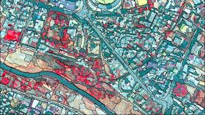
Training Course on Object-Based Image Analysis provides participants with the theoretical foundations and practical skills to harness the power of OBIA for diverse remote sensing applications, empowering them to conduct advanced spatial analysis and make informed decisions in various industries.
Training Course on Object-Based Image Analysis provides participants with the theoretical foundations and practical skills to harness the power of OBIA for diverse remote sensing applications, empowering them to conduct advanced spatial analysis and make informed decisions in various industries.
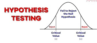
Hypothesis Testing in Spatial Data Analysis Training Course provides a comprehensive deep dive into Hypothesis Testing in Spatial Data Analysis, empowering participants with the essential geospatial analytical skills to draw statistically sound conclusions from location-based data.
Hypothesis Testing in Spatial Data Analysis Training Course provides a comprehensive deep dive into Hypothesis Testing in Spatial Data Analysis, empowering participants with the essential geospatial analytical skills to draw statistically sound conclusions from location-based data.
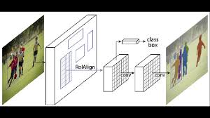
Training Course on Image Segmentation and Feature Extraction Techniques is designed to equip professionals with cutting-edge skills in computer vision and image processing, leveraging both traditional and deep learning approaches.
Training Course on Image Segmentation and Feature Extraction Techniques is designed to equip professionals with cutting-edge skills in computer vision and image processing, leveraging both traditional and deep learning approaches.
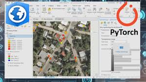
Training Course on Integrating TensorFlow/PyTorch with GIS Platforms provides a deep dive into integrating cutting-edge deep learning frameworks like TensorFlow and PyTorch with powerful GIS platforms.
Training Course on Integrating TensorFlow/PyTorch with GIS Platforms provides a deep dive into integrating cutting-edge deep learning frameworks like TensorFlow and PyTorch with powerful GIS platforms.
Training Course on Leading Geospatial Teams and Projects is meticulously designed to equip current and aspiring leaders with the essential Leadership Skills and Project Management expertise required to effectively manage and scale Geospatial Teams and deliver impactful Geospatial Projects in this data-driven era
Training Course on Leading Geospatial Teams and Projects is meticulously designed to equip current and aspiring leaders with the essential Leadership Skills and Project Management expertise required to effectively manage and scale Geospatial Teams and deliver impactful Geospatial Projects in this data-driven era
Training Course on Leveraging OpenStreetMap for Professional GIS is meticulously designed to equip GIS professionals with the cutting-edge skills and practical knowledge required to effectively integrate and leverage OpenStreetMap (OSM) data within their professional workflows.
Training Course on Leveraging OpenStreetMap for Professional GIS is meticulously designed to equip GIS professionals with the cutting-edge skills and practical knowledge required to effectively integrate and leverage OpenStreetMap (OSM) data within their professional workflows.
Training Course on GIS for Urban Resilience and Adaptation provides a deep dive into leveraging advanced geospatial tools and techniques to enhance urban resilience, fostering sustainable development and safeguarding communities against a myriad of environmental hazards and socio-economic shocks.
Training Course on GIS for Urban Resilience and Adaptation provides a deep dive into leveraging advanced geospatial tools and techniques to enhance urban resilience, fostering sustainable development and safeguarding communities against a myriad of environmental hazards and socio-economic shocks.
Training Course on GIS for Utilities Management is meticulously designed to empower utility professionals with practical, hands-on experience in applying GIS principles to real-world challenges across the electric, water, and gas sectors.
Training Course on GIS for Utilities Management is meticulously designed to empower utility professionals with practical, hands-on experience in applying GIS principles to real-world challenges across the electric, water, and gas sectors.
Training Course on GIS for Wildlife Tracking and Habitat Modeling delves into the critical role of GIS and remote sensing in understanding complex ecological relationships, assessing biodiversity hotspots, and informing data-driven conservation strategies.
Training Course on GIS for Wildlife Tracking and Habitat Modeling delves into the critical role of GIS and remote sensing in understanding complex ecological relationships, assessing biodiversity hotspots, and informing data-driven conservation strategies.
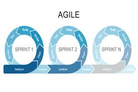
GIS Project Management and Agile Methodologies Training Course is meticulously designed to empower GIS professionals, project managers, and team leads to navigate the intricacies of geospatial initiatives with confidence
GIS Project Management and Agile Methodologies Training Course is meticulously designed to empower GIS professionals, project managers, and team leads to navigate the intricacies of geospatial initiatives with confidence