gis Courses
Comprehensive gis training programs for professionals
Comprehensive gis training programs for professionals
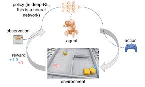
Training Course on Reinforcement Learning for Spatial Optimization focuses on understanding the core principles of RL, from Markov Decision Processes (MDPs) to advanced Deep Reinforcement Learning (DRL) algorithms, and their specific applications in Geographic Information Systems (GIS) and spatial analytics.
Training Course on Reinforcement Learning for Spatial Optimization focuses on understanding the core principles of RL, from Markov Decision Processes (MDPs) to advanced Deep Reinforcement Learning (DRL) algorithms, and their specific applications in Geographic Information Systems (GIS) and spatial analytics.
Training Course on Remote Sensing Data Sales and Marketing is meticulously designed to equip professionals with the cutting-edge skills and strategic insights necessary to thrive in the rapidly expanding remote sensing data market.
Training Course on Remote Sensing Data Sales and Marketing is meticulously designed to equip professionals with the cutting-edge skills and strategic insights necessary to thrive in the rapidly expanding remote sensing data market.
Training Course on Remote Sensing for Disaster Damage Assessment addresses the critical need for skilled professionals who can harness Earth observation data to inform timely decision-making during crisis events.
Training Course on Remote Sensing for Disaster Damage Assessment addresses the critical need for skilled professionals who can harness Earth observation data to inform timely decision-making during crisis events.
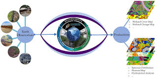
Training Course on Remote Sensing for Environmental Monitoring and Change Detection empowers participants with the skills to acquire, process, and analyze satellite imagery, aerial photography, and drone data to extract actionable insights for effective environmental management and informed decision-making.
Training Course on Remote Sensing for Environmental Monitoring and Change Detection empowers participants with the skills to acquire, process, and analyze satellite imagery, aerial photography, and drone data to extract actionable insights for effective environmental management and informed decision-making.
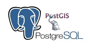
Training Course on PostGIS for Spatial Database Management introduces participants to PostGIS, a powerful spatial extension for the PostgreSQL object-relational database system.
Training Course on PostGIS for Spatial Database Management introduces participants to PostGIS, a powerful spatial extension for the PostgreSQL object-relational database system.
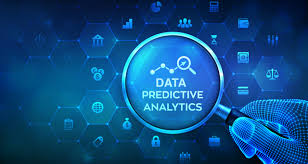
Training Course on Predictive Analytics with Spatial Data is designed to bridge the gap between traditional analytics and the evolving landscape of geospatial big data.
Training Course on Predictive Analytics with Spatial Data is designed to bridge the gap between traditional analytics and the evolving landscape of geospatial big data.
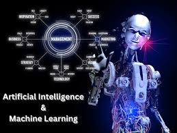
Training Course on Predictive Mapping with AI and ML delves into the transformative power of Predictive Mapping leveraging cutting-edge Artificial Intelligence (AI) and Machine Learning (ML) techniques.
Training Course on Predictive Mapping with AI and ML delves into the transformative power of Predictive Mapping leveraging cutting-edge Artificial Intelligence (AI) and Machine Learning (ML) techniques.
Training Course Probabilistic Spatial Modeling delves into the core principles and practical applications of Probabilistic Spatial Modeling. Participants will gain a deep understanding of how to effectively analyze geospatial datasets, develop predictive spatial models, and interpret results with confidence.
Training Course Probabilistic Spatial Modeling delves into the core principles and practical applications of Probabilistic Spatial Modeling. Participants will gain a deep understanding of how to effectively analyze geospatial datasets, develop predictive spatial models, and interpret results with confidence.
Training Course on Progressive Web Apps (PWAs) for Offline GIS provides a comprehensive deep dive into Progressive Web Applications (PWAs), specifically tailored for Geographic Information Systems (GIS) professionals seeking to build robust, offline-capable mapping solutions.
Training Course on Progressive Web Apps (PWAs) for Offline GIS provides a comprehensive deep dive into Progressive Web Applications (PWAs), specifically tailored for Geographic Information Systems (GIS) professionals seeking to build robust, offline-capable mapping solutions.
Training Course on Publishing and Managing Web Services is designed to equip professionals with the practical skills and theoretical understanding necessary to establish robust, scalable, and secure geospatial web infrastructures
Training Course on Publishing and Managing Web Services is designed to equip professionals with the practical skills and theoretical understanding necessary to establish robust, scalable, and secure geospatial web infrastructures
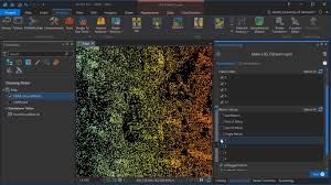
Training Course PyQGIS: Scripting and Automation in QGIS delves into the powerful capabilities of PyQGIS, the Python API for QGIS, empowering GIS professionals and developers to master geospatial scripting and workflow automation.
Training Course PyQGIS: Scripting and Automation in QGIS delves into the powerful capabilities of PyQGIS, the Python API for QGIS, empowering GIS professionals and developers to master geospatial scripting and workflow automation.
Training Course on LiDAR Data Processing, Classification, and DEM/DSM Generation provides a comprehensive deep dive into LiDAR technology, equipping participants with the essential geospatial skills to effectively process, classify, and generate highly accurate Digital Elevation Models (DEMs) and Digital Surface Models (DSMs).
Training Course on LiDAR Data Processing, Classification, and DEM/DSM Generation provides a comprehensive deep dive into LiDAR technology, equipping participants with the essential geospatial skills to effectively process, classify, and generate highly accurate Digital Elevation Models (DEMs) and Digital Surface Models (DSMs).